PrecisionPoint’s services support many of the nation’s industries considered “essential Infrastructure” as defined by the Department of Homeland Security. As such we continue to operate in a socially responsible manner to help slow the pandemic and protect the health and well-being of our employees and clients.
PrecisionPoint Welcomes James Wott as Its New Director of Operations!
PrecisionPoint Expands Team to Support Growth in its NavVis RapidScan, UAS & Traditional 3D Reality Capture Services for AECO Industries CARMEL, Indiana, June 27, 2019 – PrecisionPoint Inc. (PPI), a leading provider of 3D reality capture and BIM solutions for the architecture, engineering, construction, and operations (AECO) industry, announced today … Read More
NavVis partners with PrecisionPoint to bring the American indoors online
13 October 2017 – NavVis, the global leader in indoor mapping, visualization, and navigation, announces a new partnership with PrecisionPoint, a leading reality capture solutions provider in the USA. PrecisionPoint is now an official NavVis technology service provider offering NavVis indoor reality capture solutions to its business customers in … Read More
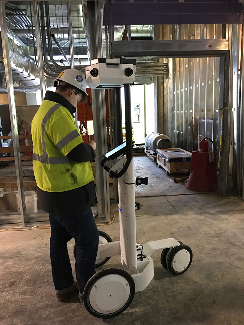
Featured Project: 50,000 Square Feet Scanned in 90 Minutes with Indoor Mobile Mapping Technology
Add Indoor Mobile Mapping to our list of enhanced service offerings. For those not yet familiar with this new technology, it employs a suite of cameras and laser scanners mounted on a trolley that can be rolled across a floor to quickly capture a 360-degree point cloud of an interior space. … Read More
Please Welcome Will Hirschfeld to the PrecisionPoint Team!
Will Hirschfeld is PrecisionPoint’s new UAS Pilot/3D Solutions Specialist. He comes to us from Beck’s Hybrid, a specialty seed company, where he became an expert on all things UAS and received his FAA Part 107 Certification. That means Will has been cleared to operate small UAVs up to 55 pounds, … Read More
